Col du Galibier
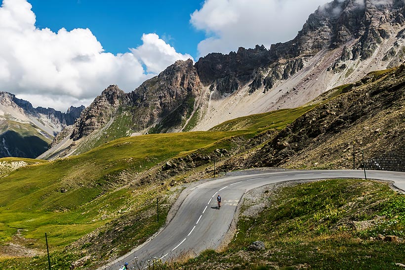
Col du Galibier is a mountain pass in the southern region of the French Dauphiné Alps near Grenoble. It is the ninth highest paved road in the Alps and the sixth highest mountain pass. It is often the highest point of the Tour de France.
It connects Saint-Michel-de-Maurienne and Briançon via the col du Télégraphe and the Col du Lautaret. It is located between the massif d'Arvan-Villards and the massif des Cerces, taking its name from the secondary chain of mountains known as the Galibier.
Before 1976, the tunnel was the only point of passage at the top, at an altitude of 2556m. The tunnel was closed for restoration until 2002, and a new road was constructed over the summit. The re-opened tunnel is a single lane controlled by traffic lights, which are among the highest such installations in Europe.
On both sides of the Col du Galibier, mountain pass cycling milestone are placed every km (As of July 2015, some are missing in the final part of the climb from the Col du Lautaret). They indicate the distance to the summit, the current height, and the average slope in the following km. Such signposting for cyclists has become common in most major mountain passes in the French Pyrenees and Alps.
- FIGURES
- FACTS
-
Region: Savoie, Rhone-Alpes, France
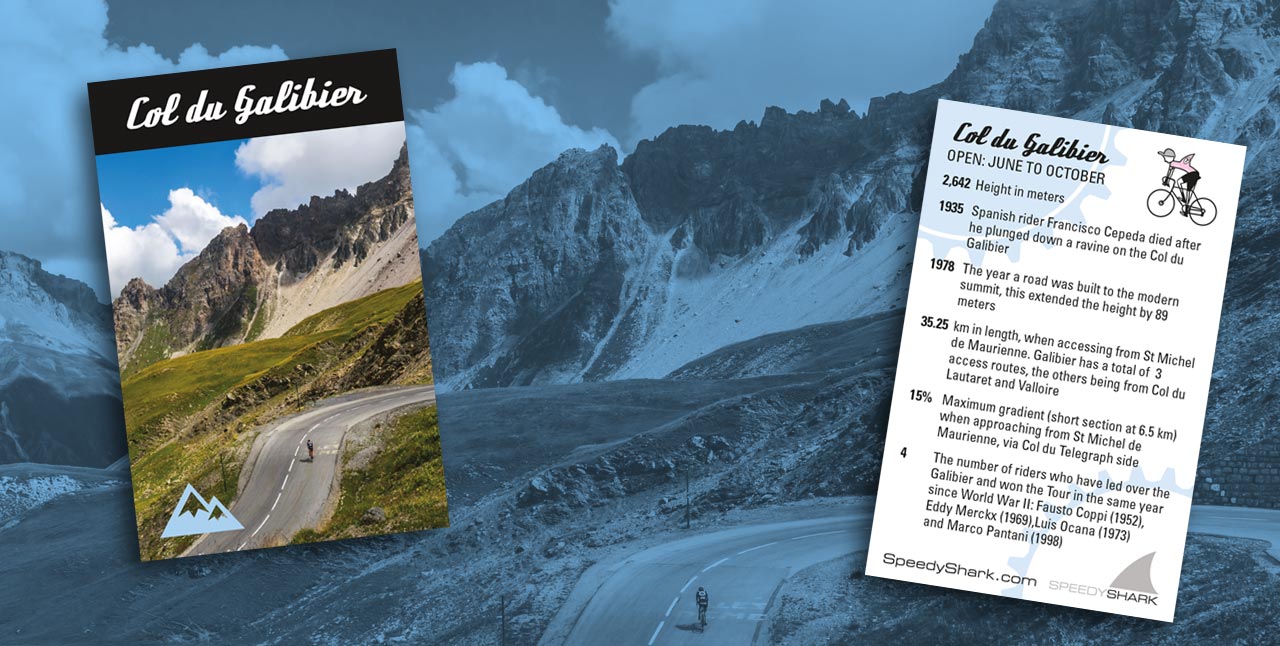
Open: June to October
Access: Galibier has three access routes, (Saint Michel de Maurienne, via Col du Telegraphe, from Col du Lautaret and from Valloire.
From: Saint Michel de Maurienne follow E70-A43 (I’Autoroute de la Maurienne) from Saint Jean de Maurienne to Saint Michel de Maurienne, turn right and follow D902 to the top.
Height: 2.642m
Length: 35.25km
Altitude Gain: 1,933m
Average Gradient: 5.48%
Maximum Gradient: 15% (short section at km 6.5)
Refreshments: Bars can be found towards the top at Valloire (km17) and at Les Verne's (km19.5).
-
In the area of the summit it was hard to travel. This was the reason why in 1890 a crest tunnel (363 meters) was built, which was opened in 1891.
The Col du Galibier is named after Le Grand Galibier, the mountain peak at 3228 metres that towers over the Col.
Col du Galibier was first made crossable for military purposes in 1879.
The Col du Galibier was first used in the Tour de France in 1911.
The original Galibier road used in the early Tour de France was in fact steeper on both sides than it is today.
The Tunnel is 365 metres long – a metre for each day of the year.
The official altitude panel at the summit says 2645 metres, it is in fact 2642 metres The first rider over the summit was Emile Georget.
In 1922, Eugene Christophe broke his bike on the descent but was able to borrow the bike of a Valloire priest to continue to the bottom before finding a better bike in Saint-Michel-de-Maurienne.
In 1998, Marco Pantani would be the first over Galibier - winning a key stage at Les Deux Alpes on his way to winning the Tour. While his main competitor, Jan Ullrich, suffered badly on the cold Glalibier descent.
The 2011 Tour climbed the Col du Galibier twice to celebrate the 100th anniversary of the first appearance of the pass in the Tour de France.
At the south portal of the tunnel, at the edge of the road, there is a monument to Henri Desgrange, instigator and first director of the Tour de France.
It was scheduled to be used again in stage 20 of the 2015 Tour, but was left out nine days before the race start due to landslides in the Chambon Tunnel, situated towards the bottom of the descent of the climb.